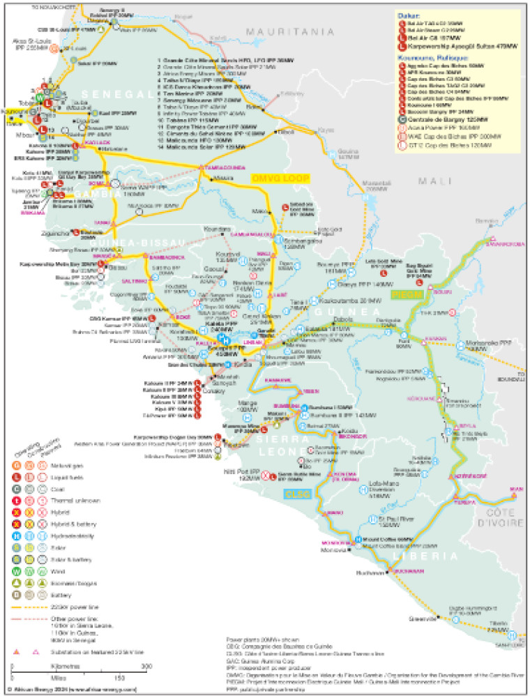
Published April 2024, this map illustrates West Africa power interconnections across Liberia, Guinea, Sierra Leone, Guinea Bissau, Gambia and Senegal.
The map shows the OMVG loop, Cote d'Ivoire-Liberia-Sierra Leone-Guinea (CLSG) line and Guinea-Mali Interconnection Project (PIEGM), with substations marked. Other actual and planned power lines across the region are also shown, ranging from 90kV to 161kV.
The locations of 20MW+ power generation facilities that are operating, under construction or planned are shown by type – including liquid fuels, natural gas, coal, hybrid, hybrid and battery, hydroelectricity, solar, solar and battery, wind, biomass/biogas and battery.
The map is presented as a PDF file using eps graphics, meaning that there is no loss of resolution as the file is enlarged.
Subscriber only content
An active subscription is required to view this article
Subscribe to African Energy
African Energy is a brand of


