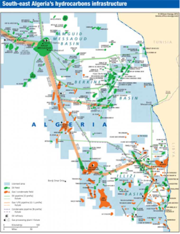
Published in April 2012 as part of the African Energy Atlas 2012, this map takes a detailed look at south east Algeria, encompassing the Amguid Messaoud, Berkine and Illizzi basins. Major oil and gads fields are shown alongside associated downstream infrastructure including pipelines, refineries, and gas processing plants.
Single African Energy map
£895
(1 standard map)
Subscribe to African Energy
African Energy is a brand of


