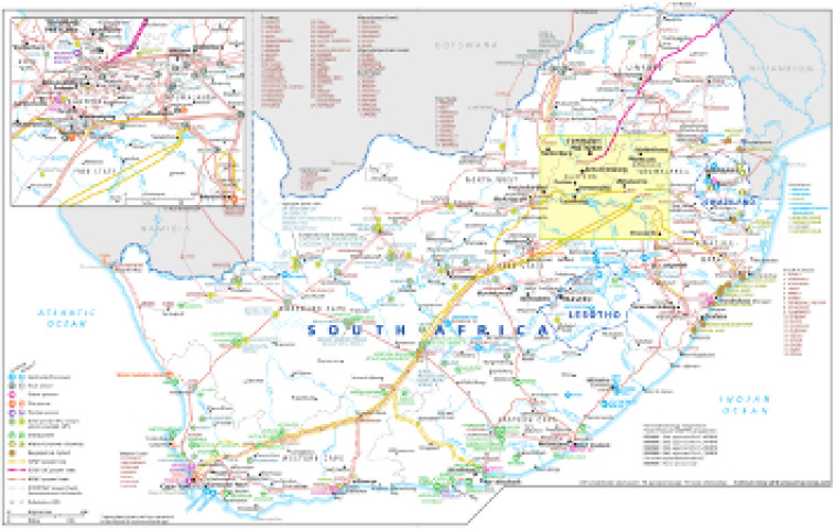
Revised for the African Energy Atlas 2016/2017, this map provides an overview of South Africa's electricity sector infrastructure. The locations of actual and planned power generation facilities – including solar and wind REIPPP projects, plus hydro, gas-fired, diesel, coal, nuclear and waste-to-power plants – are marked on the map alongside existing and future transmission lines, ranging from 220kV to 765kV.
The map is a PDF file, made using eps graphics, meaning that there is no loss of resolution as the file is enlarged.
Single African Energy map
£895
(1 standard map)
Subscribe to African Energy
African Energy is a brand of


