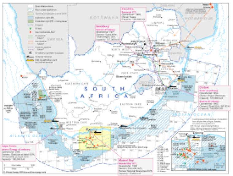
Updated in March 2022, this map provides a detailed overview of the hydrocarbons sector in South Africa.
Blocks that are open, under application and licensed (technical co-operation permit, exploration right and production right/mining lease) are shown, with block operators and oil and gas fields marked, alongside associated downstream infrastructure such as pipelines, tanker terminals, refineries and proposed LNG facilities. Panels provide basic details for the country's oil refineries, and CTL and GTL plants.
A small inset provides greater detail of the offhsore Bredasdorp Basin, Infanta sub-Basin and South Outeniqua Basin.
The map is available as a PDF file using eps graphics, meaning that there is no loss of resolution as the file is enlarged.
Access via a report
Subscribe to African Energy
African Energy is a brand of


