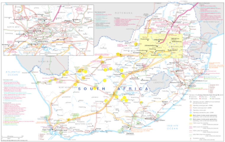
Published November 2023, this map focuses on the potential for green power to supply South Africa’s most energy intensive users.
The map shows South Africa's main areas of solar and wind power generation and their proximity to existing and planned transmission infrastructure.
The location of industrial sites (coal mines, smelters, steel works, chemicals, other mines and other industries) connected to members of South Africa's Energy Intensive Users Group are shown to illustrate the challenges in linking these sites to renewable energy power generation.
The map also shows the sites of baseload power generation - specifically operating coal, natural gas, nuclear and hydroelectric power, plus planned natural gas plants.
The transmission network shows lines that are operating or under construction or planned, ranging from 765kV to 220/275kV. Operating and under construction/planned substations are also shown.
Power generation data was drawn from our African Energy Live Data platform, which contains project level detail on power plants and projects across Africa.
The map is presented as a PDF file using eps graphics, meaning that there is no loss of resolution as the file is enlarged.
Access via a report
Subscribe to African Energy
African Energy is a brand of


