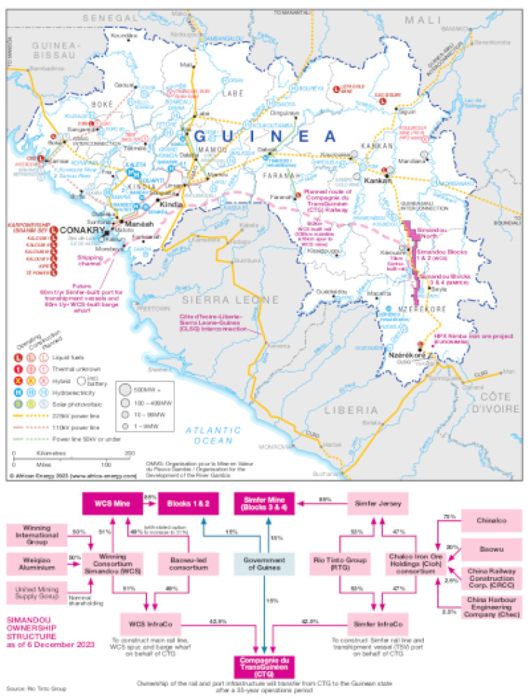
Published December 2023, this map shows the location of Guinea's Simandou iron ore projects and proposed rail and port infrastructure.
The Simandou projects are shown in the wider context of Guinea's power infrastructure including generation sites that are operating, under construction or planned and actual and planned power transmission infrastructure.
Power generation plants and projects are shown by type – including liquid fuels, hybrid, hydroelectricity and solar. Generation sites are marked with different sized circles to show sites of 1-9MW, 10-99MW, 100-499MW and 500MW and above.
Existing and future transmission and distribution lines are shown ranging from 50kV to 225kV. Actual and planned cross-border interconnectors are also shown including the Côte d'Ivoire-Liberia-Sierra Leone-Buinea (CLSG) interconnection.
Power generation data was drawn from our African Energy Live Data platform, which contains project level detail on power plants and projects across Africa.
The map is presented as a PDF file using eps graphics, meaning that there is no loss of resolution as the file is enlarged.
Single African Energy map
£895
(1 standard map)
Subscribe to African Energy
African Energy is a brand of


