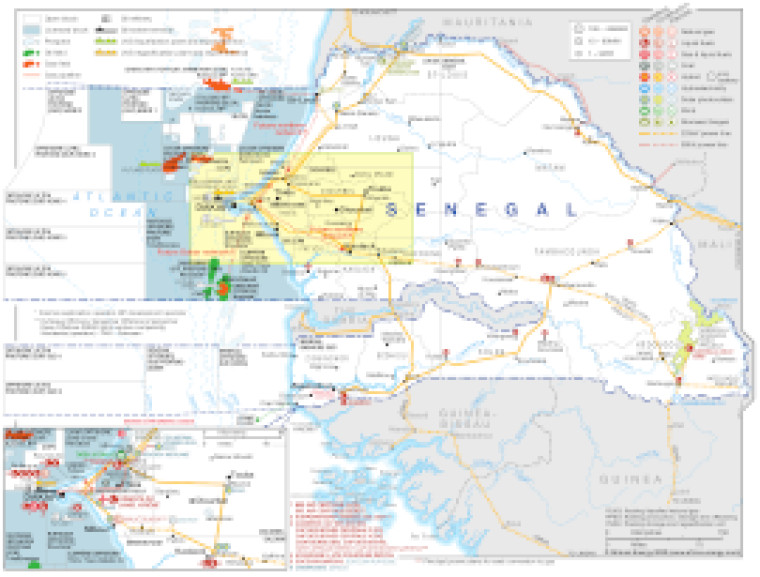
Updated in February 2022, this map provides a detailed overview of the energy sector in Senegal.
The map shows both hydrocarbons and power sector infrastructure.
Open and licensed acreage is shown, with block operators and oil and gas fields marked, alongside associated downstream infrastructure such as pipelines, tanker terminals, refineries, gas processing plants and LNG facilities.
Power generation sites are marked with different sized circles to show sites of 1-9MW, 10-99MW and 100-499MW.
The map is presented as a PDF file using eps graphics, meaning that there is no loss of resolution as the file is enlarged.
Existing and future transmission lines are shown (90kV and 225kV). Actual and planned cross-border interconnectors are also shown including lines to Guinea, Guinea-Bissau, Mali, Mauritania and The Gambia.
An inset provides a more detailed view of the onshore and offshore region surrounding Dakar.
The map is presented as a PDF file using eps graphics, meaning that there is no loss of resolution as the file is enlarged.
Single African Energy map
£895
(1 standard map)
Subscribe to African Energy
African Energy is a brand of


