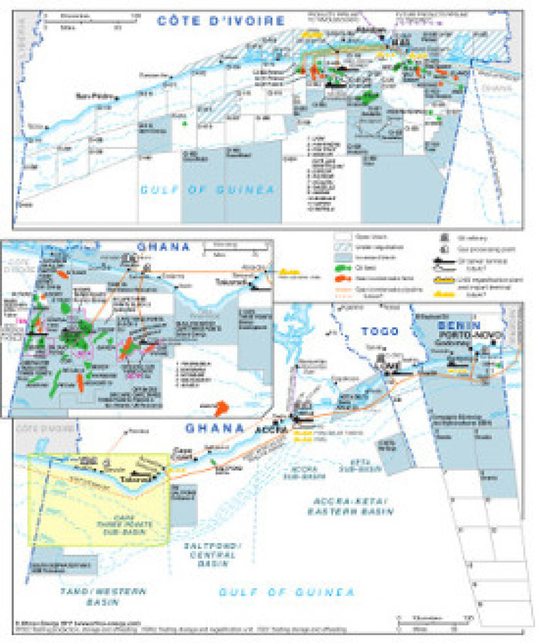
Published in September 2017, this map provides a detailed overview of offshore oil and gas infrastructure covering Côte d’Ivoire, Ghana, Togo and Benin. The revised maritime border between Côte d’Ivoire and Ghana is marked, with open and licensed acreage shown for all featured countries. Block operators are marked, with oil and gas fields shown alongside associated downstream infrastructure including LNG import and regasification facilities, pipelines (including the route of the WAGP), oil refrineries, tanker terminals and gas processing plants.
The map is a PDF file, made using eps graphics, meaning that there is no loss of resolution as the file is enlarged.
Price: £70 or available as part of a full subscription.
Single African Energy map
£895
(1 standard map)
Subscribe to African Energy
African Energy is a brand of


