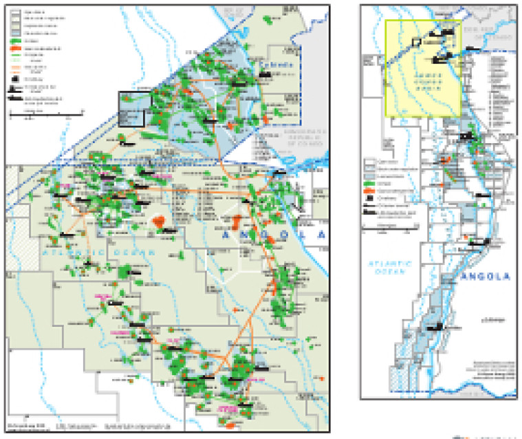
Updated in April 2020 for the African Energy Atlas, the country is shown in overview, with the greater part of the map dedicated to a more detailed look at the Lower Congo Basin.
Open and licensed acreage is shown, with block operators and oil and gas fields marked, alongside associated downstream infrastructure such as pipelines, tanker terminals, refineries and LNG facilities.
The map is available as a PDF file using eps graphics, meaning that there is no loss of resolution as the file is enlarged.
Double African Energy map
£950
(1 two-page map)
Subscribe to African Energy
African Energy is a brand of


