Oil and gas E&P in Cameroon and Equatorial Guinea


Map
Issue 257
28 June 2013

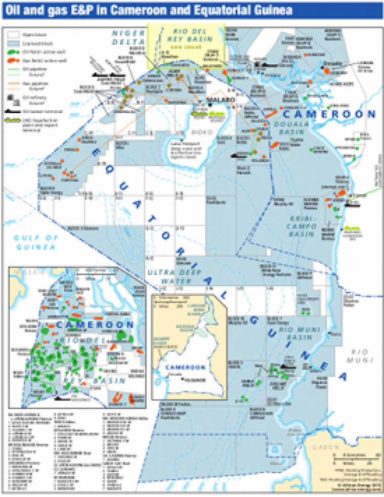
Revised June 2013, this map provides an overview of exploration activity in Cameroon and Equatorial Guinea. Open and licensed acreage is shown, with block operators marked. Detail includes locations of existing oil and gas fields as well as planned oil and gas pipelines.

Single African Energy map

£895

(1 standard map)

Subscribe to African Energy

View subscription options

Don't have an account?

Register for access to our free content

An account also allows you to view selected free articles, set up news alerts, search our African Energy Live Data power projects database and view project locations on our interactive map

Register

Interested in more than one map?

The African Energy Atlas is the essential reference book for all energy professionals working in Africa, with maps, graphics and articles covering all aspects of the energy sector.

Take a closer look