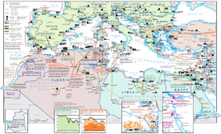
Revised in December 2021, this map focuses on North Africa's energy infrastructure and international connections, including electricity interconnections and oil and gas pipelines. Text panels provide notes on a selection of major projects.
Across North Africa sites of major oil and gas fields are shown alongside pipeline infrastructure. In addition to interconnections from North Africa to Europe, the map covers the entire Mediterranean Basin, showing major tanker terminals, gas processing plants and LNG facilities across the southern part of Europe, Syria, Lebanon and Israel.
The map is presented as a PDF file using eps graphics, meaning that there is no loss of resolution as the file is enlarged.
Double African Energy map
£950
(1 two-page map)
Subscribe to African Energy
African Energy is a brand of


