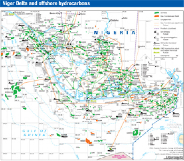
Published in April 2012 as part of the African Energy Atlas 2012, this map takes a detailed look at the Niger Delta region. Oil and gas fields are shown alongside associated downstream infrastructure including pipelines, refineries, tanker terminals, gas processing plants and LNG facilities. The map was originally published alongside a separate map providing an overview of Nigeria's hydrocarbons infrastructure.
Single African Energy map
£895
(1 standard map)
Subscribe to African Energy
African Energy is a brand of


