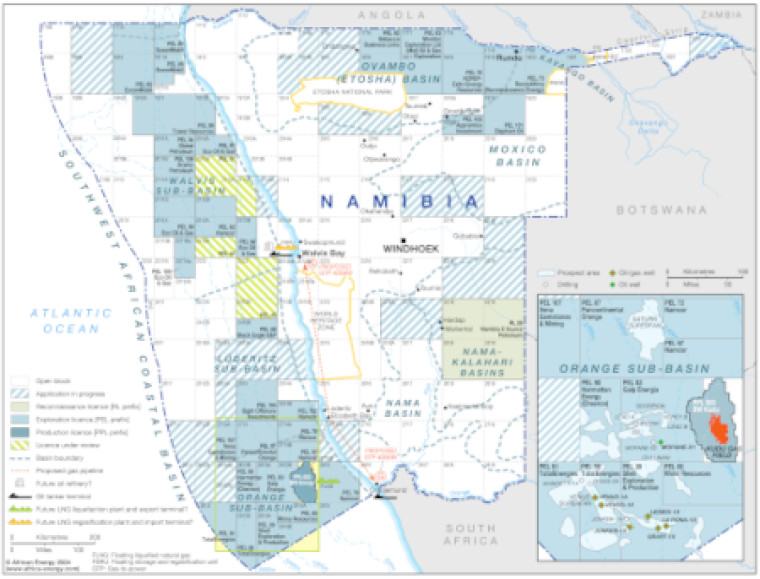
Updated January 2024, this map provides a detailed overview of the hydrocarbons sector in Namibia.
The map shows blocks that are open, under application, under review and licensed. Licensed blocks are shaded to show reconnaissance, exploration and production acreage. Block operators and oil and gas fields are marked, with basin boundaries and names shown.
The map also illustrates associated mid- and downstream infrastructure such as pipelines, tanker terminals, refineries and LNG facilities.
An inset provides a more detailed view of the blocks and discoveries in the Orange sub-basin.
The map is available as a PDF file using eps graphics, meaning that there is no loss of resolution as the file is enlarged.
Single African Energy map
£895
(1 standard map)
Subscribe to African Energy
African Energy is a brand of


