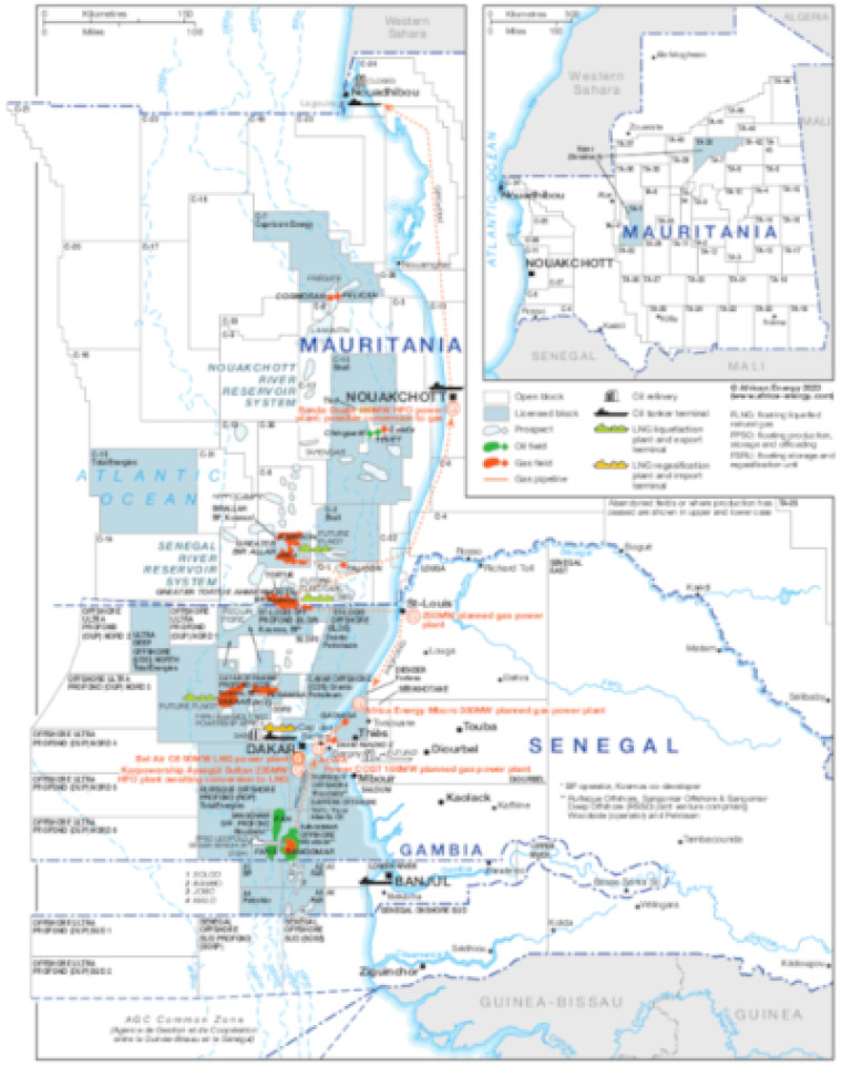
Updated October 2023, this map provides a detailed overview of the hydrocarbons sector in Mauritania, Senegal and Gambia.
The main map focuses on the offshore including planned and potential LNG developments around the Greater Tortue Ahmeyim (GTA), Greater Bir Allah and Yakaar Teranga (Y-T) gas fields. An inset focuses on Mauritania's onshore blocks
Blocks that are open and licensed are shown, with block operators and oil and gas fields marked alongside exploration prospects. The map also illustrates mid- and downstream infrastructure such as pipelines, tanker terminals, refineries and LNG facilities.
In addition, the location of planned and operating gas-fired power generation plants in Senegal and Mauritania are shown.
The map is available as a PDF file using eps graphics, meaning that there is no loss of resolution as the file is enlarged.
Single African Energy map
£895
(1 standard map)
Subscribe to African Energy
African Energy is a brand of


