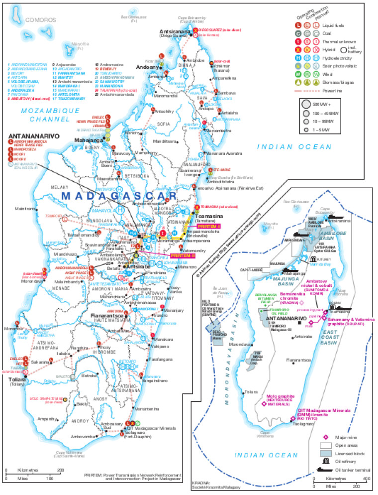
Revised in June 2023, this map provides a detailed view of the energy sector in Madagascar. The locations of power generation facilities that are operating, under construction or planned are shown by type – including liquid fuels, coal, hybrid, hydroelectricity, solar PV, wind and biomass/biogas.
Generation sites are marked with different sized circles to show sites of 1-9MW, 10-99MW, 100-499MW and 500MW and above.
Existing and future transmission and distribution lines are shown.
An inset shows the location of major mines plus oil and gas infrastructure including open and licensed blocks, tanker terminals and actual and planned refineries.
Power generation data was drawn from our African Energy Live Data platform, which contains project level detail on power plants and projects across Africa.
The map is presented as a PDF file using eps graphics, meaning that there is no loss of resolution as the file is enlarged.
Single African Energy map
£895
(1 standard map)
Subscribe to African Energy
African Energy is a brand of


