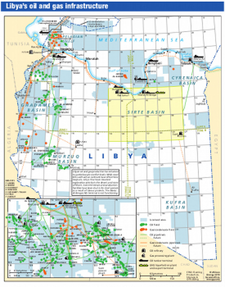
Revised April 2013, this map provides an overview of Libya's hydrocarbons infrastructure. Oil and gas fields are marked, with open and licensed acreage shown. An inset provides a more detailed look at the Sirte Basin. Associated downstream infrastructure is also shown including oil and gas pipelines, oil refineries, tanker terminals, LNG liquefaction plants and export terminals, and gas processing plants. The map is a pdf file. The images are made using eps graphics, which don't lose resolution as they are enlarged.
Single African Energy map
£895
(1 standard map)
Subscribe to African Energy
African Energy is a brand of


