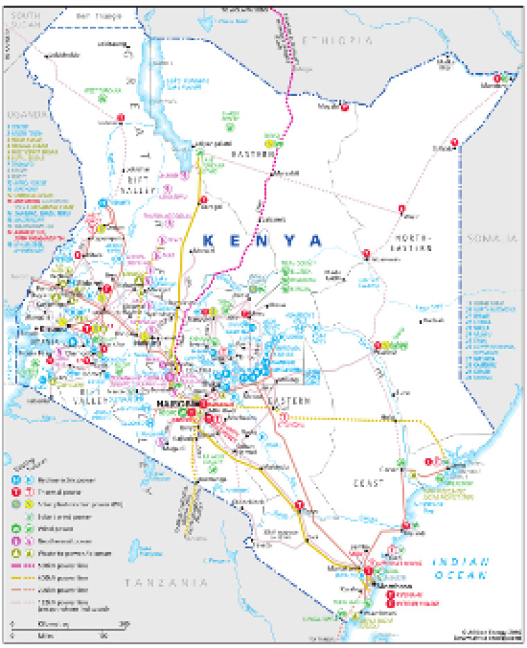
Revised for the African Energy Atlas 2016/2017, this map provides an overview of electricity sector infrastructure in Kenya.
The locations of actual and planned power generation facilities – including solar PV, wind, hydro, thermal, geothermal and waste-to-power plants – are marked alongside existing and future transmission lines, ranging from 33kVkV to 500kV. Cross-border power interconnectors, including the planned Eastern Electricity Highway Project and the Zambia-Tanzania-Kenya interconnection, are shown.
The map is a PDF file, made using eps graphics, meaning there is no loss of resolution as the file is enlarged.
Single African Energy map
£895
(1 standard map)
Subscribe to African Energy
African Energy is a brand of


