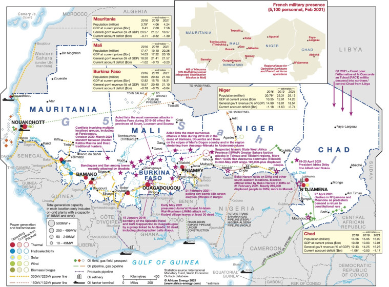
Published in May 2021, this map provides an overview of infrastructure and conflict flash points in the Sahel region- covering Mauritania, Mali, Burkina Faso, Niger and Chad.
Power generation sites that are under construction operating and planned are shown by type (thermal, hydroelectricity, solar, wind, biomass/biogas) alongside major actual and planned transmission lines.
The location of oil and gas fields and pipelines are also shown.
Annotations outlining conflict areas and flash points are included alongside population and economic statistics for the Sahel countries.
The map is available as a PDF file using eps graphics, meaning that there is no loss of resolution as the file is enlarged.
Single African Energy map
£895
(1 standard map)
Subscribe to African Energy
African Energy is a brand of


