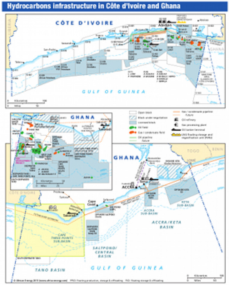
Revised April 2013, this map provides an overview of exploration and production activity in Côte d’Ivoire and Ghana. Oil and gas fields are marked, with block operators named and open acreage shown. Associated downstream infrastructure is also shown including oil and gas pipelines, tanker terminals and gas processing plants. The map is a pdf file. The images are made using eps graphics, which don't lose resolution as they are enlarged.
Single African Energy map
£895
(1 standard map)
Subscribe to African Energy
African Energy is a brand of


