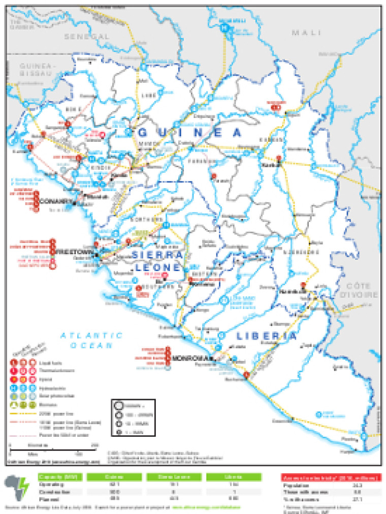
Revised in August 2018, this map provides a detailed overview of the power sector in Guinea, Sierra Leone and Liberia.
The locations of power generation facilities that are operating, under construction or planned are shown by type – including liquid fuels, thermal, hybrid, hydroelectric, solar (PV) and biomass. Generation sites are marked with different sized circles to show sites of 1-9MW, 10-99MW, 100-499MW and 500MW and above.
Existing and future transmission lines are shown ranging from 110kV to 225kV (some lower voltage lines of 50Kv and under are also marked). Actual and planned cross-border interconnectors are also shown including lines to Côte d'Ivoire, Guinea-Bissau, Mali and Senegal.
The map was originally published as part of the African Energy Atlas 2018/2019 and is available as a PDF file using eps graphics, meaning that there is no loss of resolution as the file is enlarged.
Power generation data was drawn from our African Energy Live Data platform, which contains project level detail on more than 5,500 power plants and projects across Africa.
Single African Energy map
£895
(1 standard map)
Subscribe to African Energy
African Energy is a brand of


