Ghana's oil and gas infrastructure map


Map
Issue 305
25 July 2015

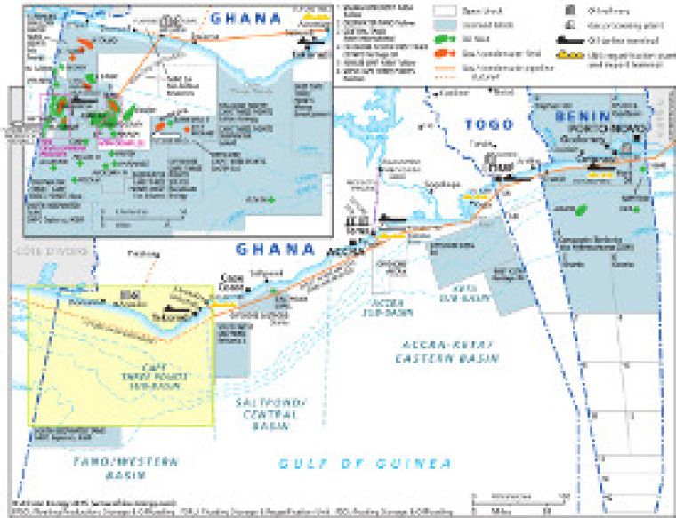
Published as part of African Energy 305, this map shows details of oil and gas exploration and production activities. Open and licensed blocks are shown on the map, as well as associated infrastructure such as the locations of pipelines and tanker terminals.

The map is a PDF file, made using eps graphics, meaning that there is no loss of resolution as the map is enlarged.

Single African Energy map

£895

(1 standard map)

Subscribe to African Energy

View subscription options

Don't have an account?

Register for access to our free content

An account also allows you to view selected free articles, set up news alerts, search our African Energy Live Data power projects database and view project locations on our interactive map

Register

Interested in more than one map?

The African Energy Atlas is the essential reference book for all energy professionals working in Africa, with maps, graphics and articles covering all aspects of the energy sector.

Take a closer look