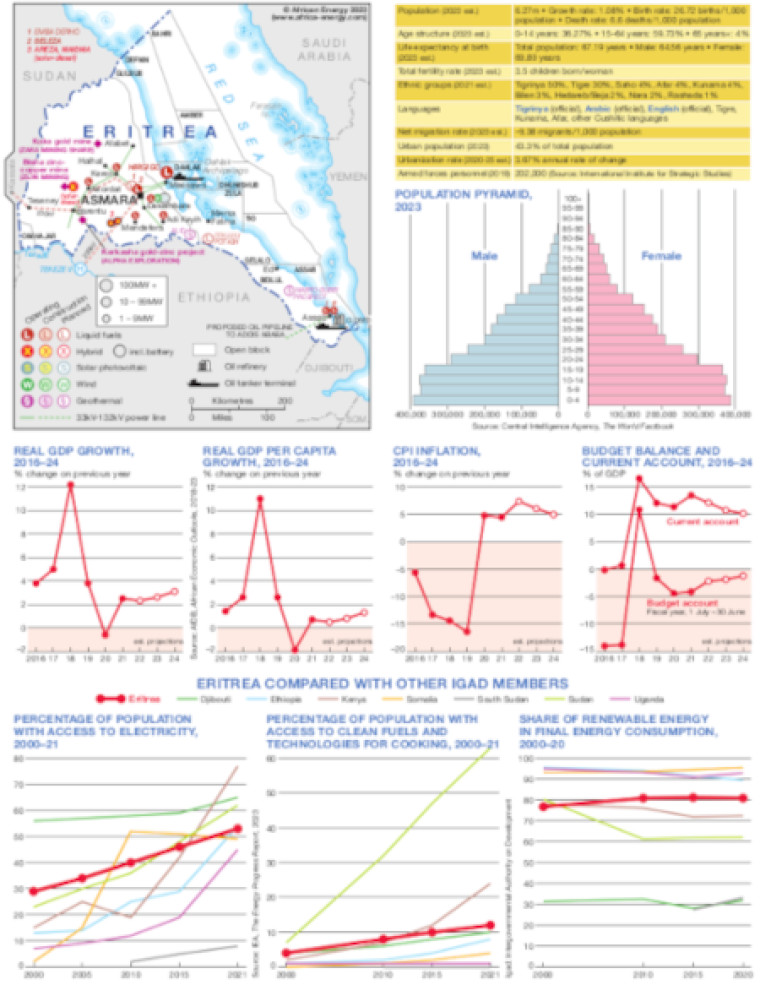
Published July 2023, this file consists of a small energy map of Eritrea and a series of charts illustrating economic and social data.
The map shows by type the locations of power generation facilities that are operating, under construction or planned – including liquid fuels, hybrid, solar PV, wind and geothermal.
Generation sites are marked with different sized circles to show sites of 1-9MW, 10-99MW and 100MW and above.
The map also shows open oil and gas blocks, the location of tanker terminals and the country's closed oil refinery.
A table provides a summary of key population demographics, with a population pyramid below.
Four small charts show trends for the 2016-2024 period focused on real GDP growth, per capita real GDP growth, CPI inflation and budget balance/current account.
Three other charts compare Eritrea to Djibouti, Ethiopia, Kenya, South Sudan, Sudan and Uganda for key indicators focused on, access to electricity, access to clean fuel and clean fuel technologies and share of renewable energy in final energy consumption.
Single African Energy map
£895
(1 standard map)
Subscribe to African Energy
African Energy is a brand of


