Electricity infrastructure in Western WAPP Francophone countries


Map
Issue 281
11 July 2014

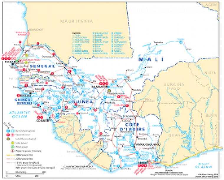
Revised July 2014, this map provides an overview of electricity infrastructure in Côte d'Ivoire, Guinea, Guinea Bissau, Mali and Senegal. Actual and planned generation projects (including hydroelectric, thermal, solar, wind and waste-to-power/biofuels sites) are shown alongside transmission lines ranging from 90kV to330kV. The map is a pdf file. The images are made using eps graphics, which don't lose resolution as they are enlarged.

Single African Energy map

£895

(1 standard map)

Subscribe to African Energy

View subscription options

Don't have an account?

Register for access to our free content

An account also allows you to view selected free articles, set up news alerts, search our African Energy Live Data power projects database and view project locations on our interactive map

Register

Interested in more than one map?

The African Energy Atlas is the essential reference book for all energy professionals working in Africa, with maps, graphics and articles covering all aspects of the energy sector.

Take a closer look