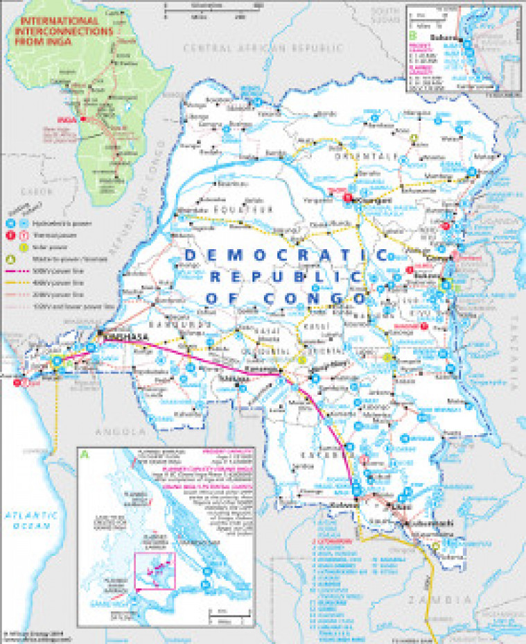
Revised November 2014, this map provides an overview of the major power generation and transmission infrastructure in the Democratic Republic of Congo. Inset provide a more detailed look at the Inga dam projects, international interconnections from Inga, and the Ruzizi projects along the border with Rwanda. Generation projects (existing and planned) include thermal, hydroelectric, solar and biomass sites. The map is a pdf file. The images are made using eps graphics, which don't lose resolution as they are enlarged.
Single African Energy map
£895
(1 standard map)
Subscribe to African Energy
African Energy is a brand of


