DR Congo country map


Map

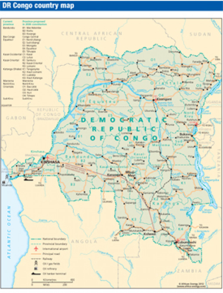
Revised August 2012, this map of Democratic Republic of Congo shows the location of principal roads, railways, airports and settlements. Current provinces are marked alongside proposed changes to provinces proposed by the 2006 constitution.

Subscribe to African Energy

View subscription options

This map is available to registered users

Login

Don't have an account?

Register for access to our free content

An account also allows you to view selected free articles, set up news alerts, search our African Energy Live Data power projects database and view project locations on our interactive map

Register

Interested in more than one map?

The African Energy Atlas is the essential reference book for all energy professionals working in Africa, with maps, graphics and articles covering all aspects of the energy sector.

Take a closer look