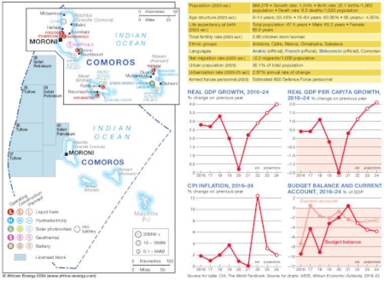
Published February 2024 this map presents an overview of Comoros' energy infrastructure, alongside key economic data and demographics.
The main map takes two view of Comoros, showing offshore oil and gas exploration acreage and power generation sites across the islands.
The locations of power generation facilities that are operating, under construction or planned are shown by type – including liquid fuels, hydroelectricity, solar PV, geothermal and battery.
Generation sites are marked with different sized circles to show sites of 0.1-9MW, 10-19MW, and 20MW and above.
Power generation data was drawn from our African Energy Live Data platform.
A panel provides a selection of demographic indicators, while four small trend charts show real GDP growth, real GDP growth per capita, CPI inflation and budget balance/current account.
Single African Energy map
£895
(1 standard map)
Subscribe to African Energy
African Energy is a brand of


