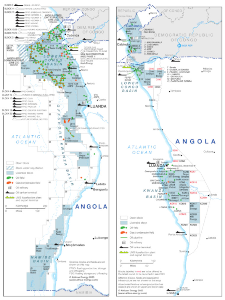
Updated May 2023, this map provides a detailed overview of the hydrocarbons sector in Angola. The map is divided into two parts, with the left hand side showing offshore acreage and the right hand side focused on the onshore.
Blocks that are open, under application and licensed are shown, with block operators named. Oil and gas fields are marked, alongside associated downstream infrastructure such as pipelines, FPSOs, tanker terminals, refineries and LNG facilities.
The map is available as a PDF file using eps graphics, meaning that there is no loss of resolution as the file is enlarged.
Single African Energy map
£895
(1 standard map)
Subscribe to African Energy
African Energy is a brand of


