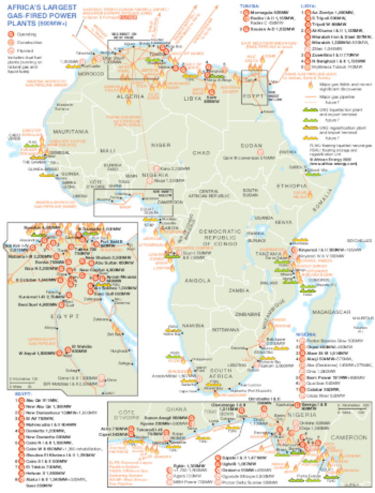
Published December 2022, this map illustrates Africa's largest (500MW-plus) gas-fired power projects and plants that are operating, under construction or planned. Plant and project locations are marked and named alongside other significant gas producing sites and infrastructure including actual and proposed pipelines and LNG facilities.
Three insets show in greater detail Egypt, northern Algeria, and the West and Central Africa coast from Côte d'Ivoire to Equatorial Guinea.
The maps also includes three African Energy Live Data charts showing Installed and pipeline on-grid gas-fired capacity by region (2010-27), Pipeline additions by ownership (2022-27) and Installed and pipeline on-grid gas-fired capacity by fuel (2010-27).
Single African Energy map
£895
(1 standard map)
Subscribe to African Energy
African Energy is a brand of


