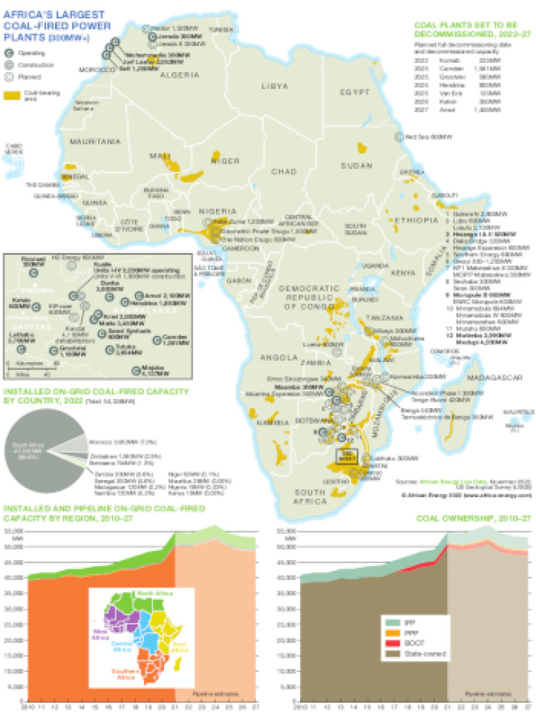
Published November 2022, this map shows the locations of Africa's largest coal-fired power plants that are operating, under construction or planned. The map also shows major coal-bearing areas throughout the continent. An inset shows an enlargement of the main region of coal-fired plants in South Africa. A small table lists the names and dates of coal plants that have published decommissioning dates.
Included with the map are three charts: a small pie showing installed on-grid coal-fired capacity by country and two stacked trends charts for the 2010-27 period showing installed and pipeline on-grid coal-fired capacity by region and coal ownership.
Power generation data was drawn from our African Energy Live Data platform, which contains project level detail on power plants and projects across Africa.
The map is presented as a PDF file using eps graphics, meaning that there is no loss of resolution as the file is enlarged.
Single African Energy map
£895
(1 standard map)
Subscribe to African Energy
African Energy is a brand of


