South African and Namibian exploration and production frontiers


Map

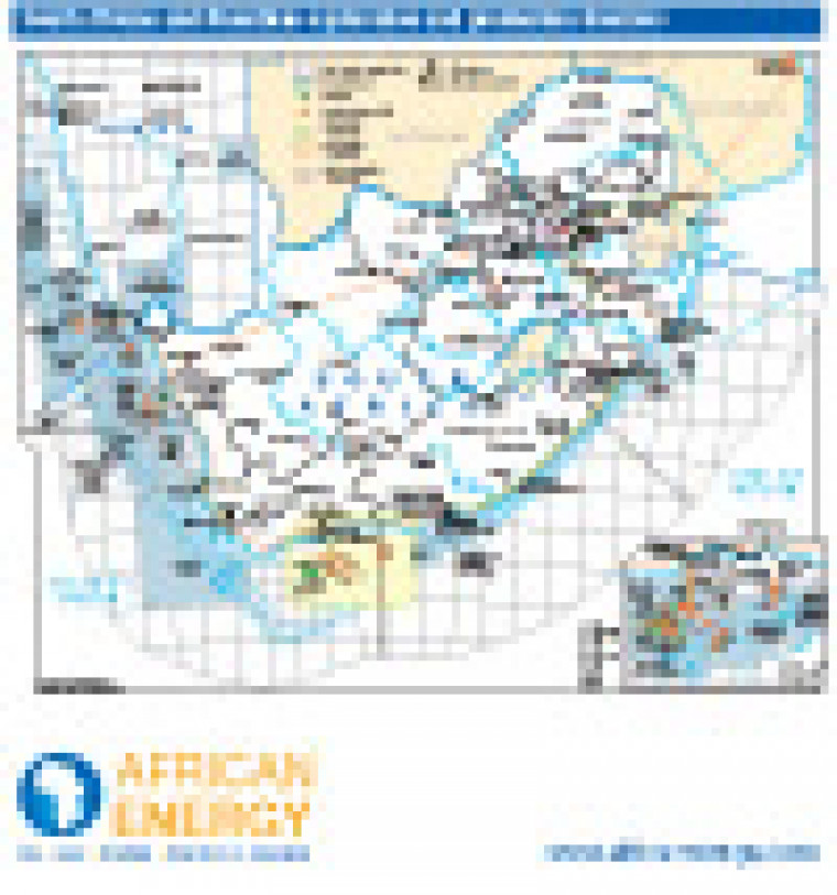
Published in January 2011 as part of the African Energy Atlas 2011, this map shows exploration and production acreage in South Africa and southern Namibia. Open and licensed acreage is shown, with block names and operators. Associated infrastructure including pipelines, refineries and tanker terminals are marked.

Single African Energy map

£895

(1 standard map)

Subscribe to African Energy

View subscription options

Don't have an account?

Register for access to our free content

An account also allows you to view selected free articles, set up news alerts, search our African Energy Live Data power projects database and view project locations on our interactive map

Register

Interested in more than one map?

The African Energy Atlas is the essential reference book for all energy professionals working in Africa, with maps, graphics and articles covering all aspects of the energy sector.

Take a closer look