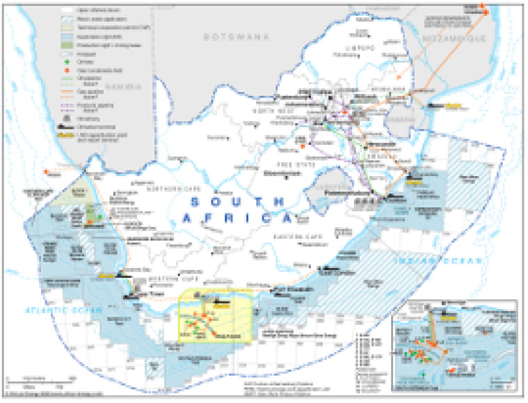
Revised in September 2020, this map provides an overview of the hydrocarbons sector in South Africa.
A small inset shows the Bredasdorp Basin offshore area in greater detail.
Oil and gas blocks shown are shaded according to their status (open, under application, technical co-operation permit, exploration right or production right/mining lease). Block operators and oil and gas fields are marked, alongside associated downstream infrastructure such as oil and gas pipelines, tanker terminals, refineries, and proposed LNG facilities.
The map is available as a PDF file using eps graphics, meaning that there is no loss of resolution as the file is enlarged.
Single African Energy map
£895
(1 standard map)
Subscribe to African Energy
African Energy is a brand of


