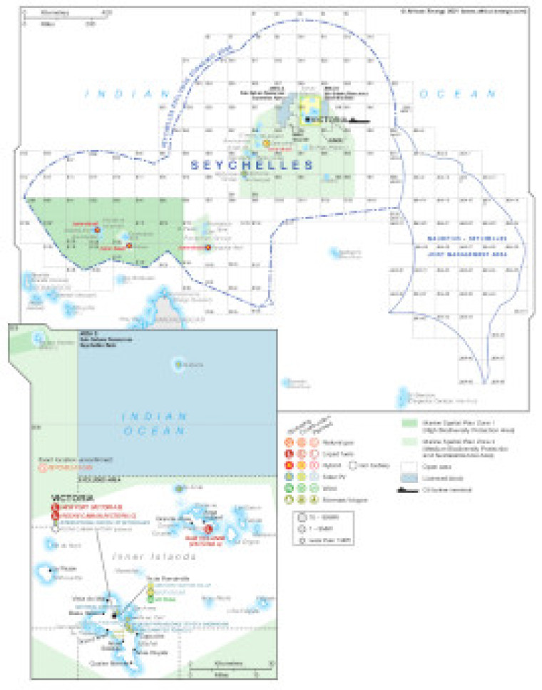
Published in April 2021, this map provides an overview of the hydrocarbons exploration and power generation sites in the Seychelles.
Open and licensed acreage is shown, with blocks in the Marine Spatial Plan Zones 1 and 2 biodiversity protection areas marked.
The locations of power generation facilities that are operating, under construction or planned are shown by type – including liquid fuels, natural gas, hybrid, solar (PV), wind and biomass/biogas.
Generation sites are marked with different sized circles to show sites of less than 1 MW, 1-9M and 10-99MW.
The map is available as a PDF file using eps graphics, meaning that there is no loss of resolution as the file is enlarged.
Single African Energy map
£895
(1 standard map)
Subscribe to African Energy
African Energy is a brand of


