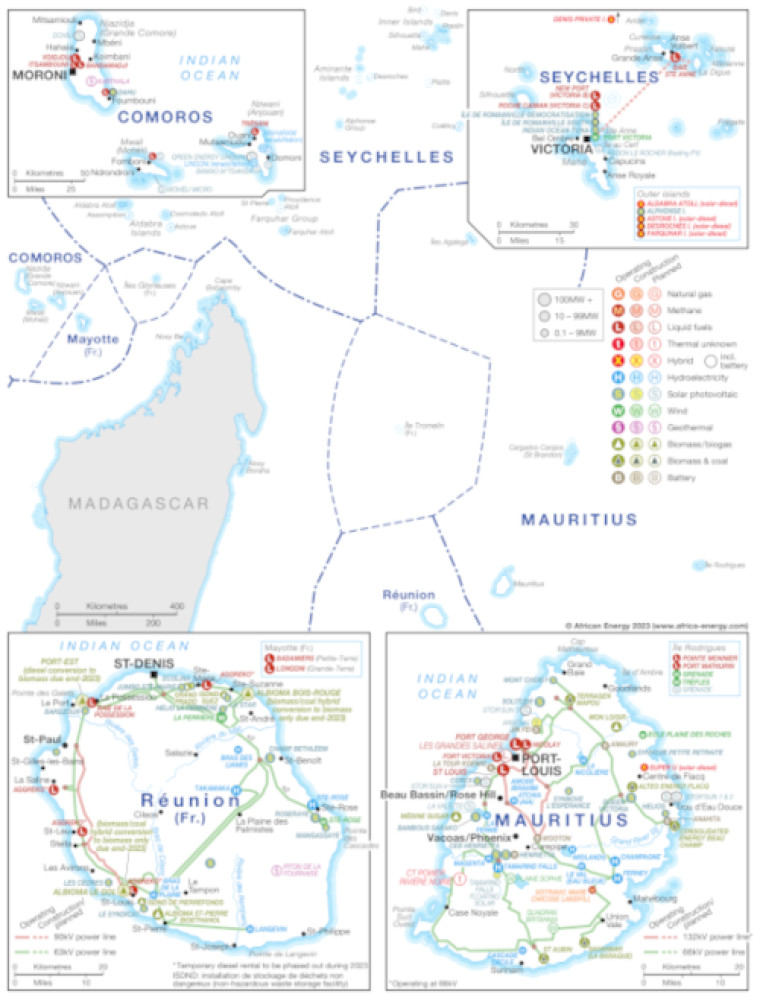
Published May 2023, this map provides a detailed view of power infrastructure across the Indian Ocean islands of Comoros, Mauritius, Réunion and Seychelles. The map shows the location of the islands within the region, with an inset for each illustrating their respective power infrastructure.
The locations of power generation facilities that are operating, under construction or planned are shown by type – including liquid fuels, natural gas, methane, geothermal, hybrid, hydroelectricity, solar PV, wind and biomass/biogas, biomass/coal and battery.
Generation sites are marked with different sized circles to show sites of 0.1-9MW, 10-99MW, and 100MW and above.
Existing and future transmission and distribution lines are shown ranging from 63kV to 132kV.
Power generation data was drawn from our African Energy Live Data platform, which contains project level detail on power plants and projects across Africa.
The map is presented as a PDF file using eps graphics, meaning that there is no loss of resolution as the file is enlarged.
Single African Energy map
£895
(1 standard map)
Subscribe to African Energy
African Energy is a brand of


