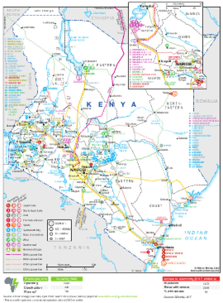
Updated in April 2020 for the African Energy Atlas, this map provides a detailed overview of the power sector in Kenya, with an inset showing grater detail around Nairobi and Lake Naivasha. The locations of power generation facilities that are operating, under construction or planned are shown by type – including liquid fuels, gas and liquid fuels, coal, other thermal, hybrid, hydroelectric, solar (PV), wind, geothermal and biomass.
Generation sites are marked with different sized circles to show sites of 3-9MW, 10-99MW, 100-499MW and 500MW-plus.
Existing and future transmission lines are shown ranging from 132kV to 500kV. Actual and planned cross-border interconnectors are also shown including lines to Ethiopia, South Sudan, Tanzania and Uganda.
Power generation data was drawn from our African Energy Live Data platform, which contains project level detail on power plants and projects across Africa.
The map is available as a PDF file using eps graphics, meaning that there is no loss of resolution as the file is enlarged.
Single African Energy map
£895
(1 standard map)
Subscribe to African Energy
African Energy is a brand of


