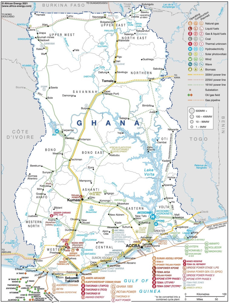
Revised in January 2021, this map provides a detailed overview of the power sector in Ghana. The locations of power generation facilities that are operating, under construction or planned are shown by type – including liquid fuels, gas and liquid fuels, natural gas, coal, hydroelectricity, solar (PV), wind, thermal, wave and biomass/biogas.
Offshore oil and gas fields are also shown.
Existing and future transmission and distribution lines are included ranging from 161kV to 330kV. Actual and planned cross-border interconnectors are also shown including lines to Côte d'Ivoire, Togo and Burkina Faso.
Power generation data was drawn from our African Energy Live Data platform, which contains project level detail on power plants and projects across Africa.
The map is available as a PDF file using eps graphics, meaning that there is no loss of resolution as the file is enlarged.
Single African Energy map
£895
(1 standard map)
Subscribe to African Energy
African Energy is a brand of


