Oil and gas infrastructure in Senegal, Mauritania and The Gambia - revised April 2021


Mauritania, Senegal, Gambia oil map
Issue 436
15 April 2021

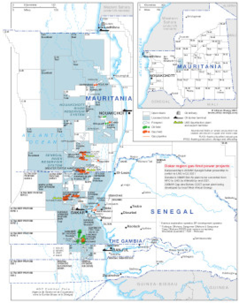
This map of Senegal, Mauritania and The Gambia, revised in April 2021, indicates open and licensed blocks, prospects, and oil and gas fields.

Associated infrastructure is also marked including gas pipelines, oil refineries, oil tanker terminals and LNG liquefaction plant and export terminals.

The map is available as a PDF file using eps graphics, meaning that there is no loss of resolution as the file is enlarged.

Single African Energy map

£895

(1 standard map)

Subscribe to African Energy

View subscription options

Don't have an account?

Register for access to our free content

An account also allows you to view selected free articles, set up news alerts, search our African Energy Live Data power projects database and view project locations on our interactive map

Register

Interested in more than one map?

The African Energy Atlas is the essential reference book for all energy professionals working in Africa, with maps, graphics and articles covering all aspects of the energy sector.

Take a closer look