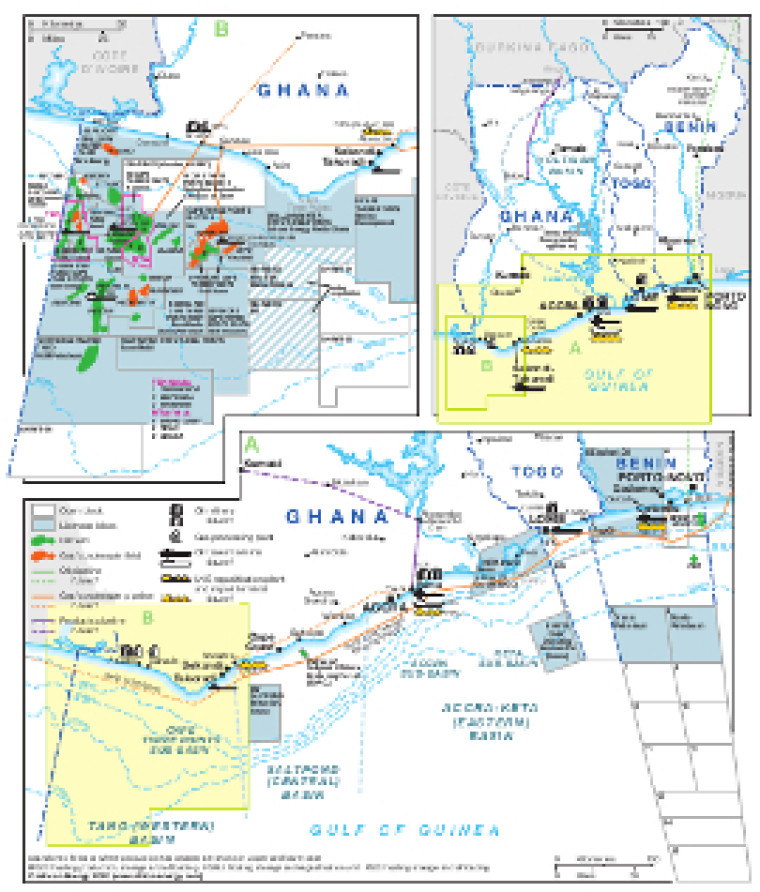
Updated in April 2020 for the African Energy Atlas, this map provides a detailed overview of the hydrocarbons sector in Ghana, Togo and Benin.
A small map provides a basic overview while greater detail is shown for the Gulf of Guinea, including open and licensed acreage, proposed LNG FSRUs and the West Africa Gas Pipeline - WAGP).
An inset focuses on the Cape Three Points sub-Basin, where oil and gas fields are marked alongside associated downstream infrastructure such as pipelines, tanker terminals, refineries and gas processing plants.
The map is available as a PDF file using eps graphics, meaning that there is no loss of resolution as the file is enlarged.
Single African Energy map
£895
(1 standard map)
Subscribe to African Energy
African Energy is a brand of


