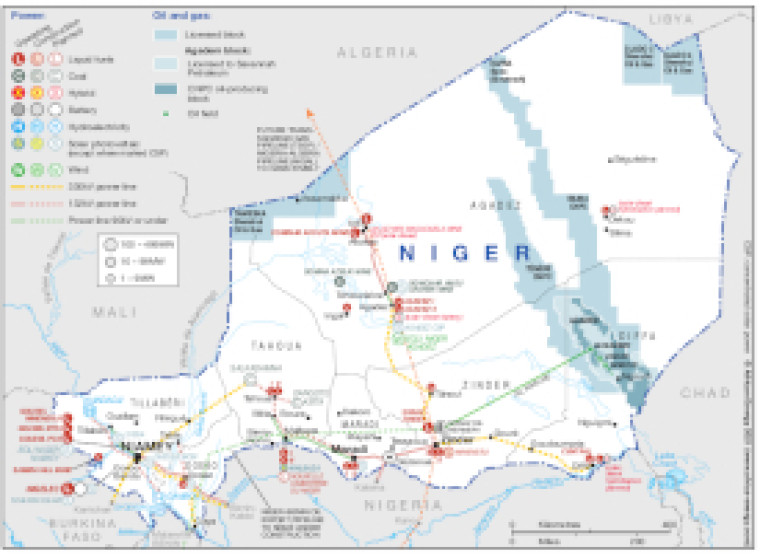
Published September 2021, this map provides a detailed overview of the energy sector in Niger. The locations of power generation facilities that are operating, under construction or planned are shown by type – including liquid fuels, coal, hybrid, hydroelectricity, solar (PV) and wind.
Generation sites are marked with different sized circles to show sites of 1-9MW, 10-99MW and 100-499MW. Projects including battery storage are marked.
Existing and future transmission and distribution lines are shown ranging from 90kV and under to 330kV. Actual and planned cross-border interconnectors are also shown including lines to Algeria, Burkina Faso and Nigeria.
The map also shows licensed oil and gas blocks (with operators marked), plus the path of an oil pipeline from the Agadem block to the Soraz oil refinery.
Power generation data was drawn from our African Energy Live Data platform, which contains project level detail on power plants and projects across Africa.
The map is available as a PDF file using eps graphics, meaning that there is no loss of resolution as the file is enlarged.
Single African Energy map
£895
(1 standard map)
Subscribe to African Energy
African Energy is a brand of


