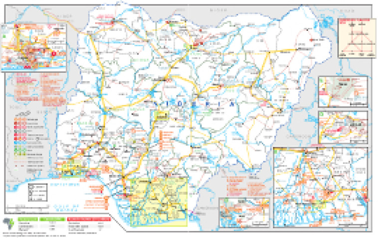
Revised in September 2020, this double page map provides a detailed overview of the power sector in Nigeria. The locations of power generation facilities that are operating, under construction or planned are shown by type – including liquid fuels, gas and liquid fuels, natural gas, coal, hybrid, hydroelectricity, solar (PV), wind and biomass/biogas.
Generation sites are marked with different sized circles to show sites of 4-9MW, 10-99MW, 100-999MW and 1,000MW and above. Projects including battery storage are marked.
A larger inset shows in greater detail a region from the Niger Delta east of Warri to Calabar in the east and Onitsha in the north. The area from Port Harcourt east to Afam is afforded its own inset.
Other insets show a diagram of the supergrid plan for 2030 and the areas around Lagos, Kano and Abuja.
Existing and future transmission and distribution lines are shown ranging from 132kV to 330kV. Actual and planned cross-border interconnectors are also shown including lines to Benin, Cameroon and Niger.
Power generation data was drawn from our African Energy Live Data platform, which contains project level detail on power plants and projects across Africa.
The map is available as a PDF file using eps graphics, meaning that there is no loss of resolution as the file is enlarged.
Double African Energy map
£950
(1 two-page map)
Subscribe to African Energy
African Energy is a brand of


