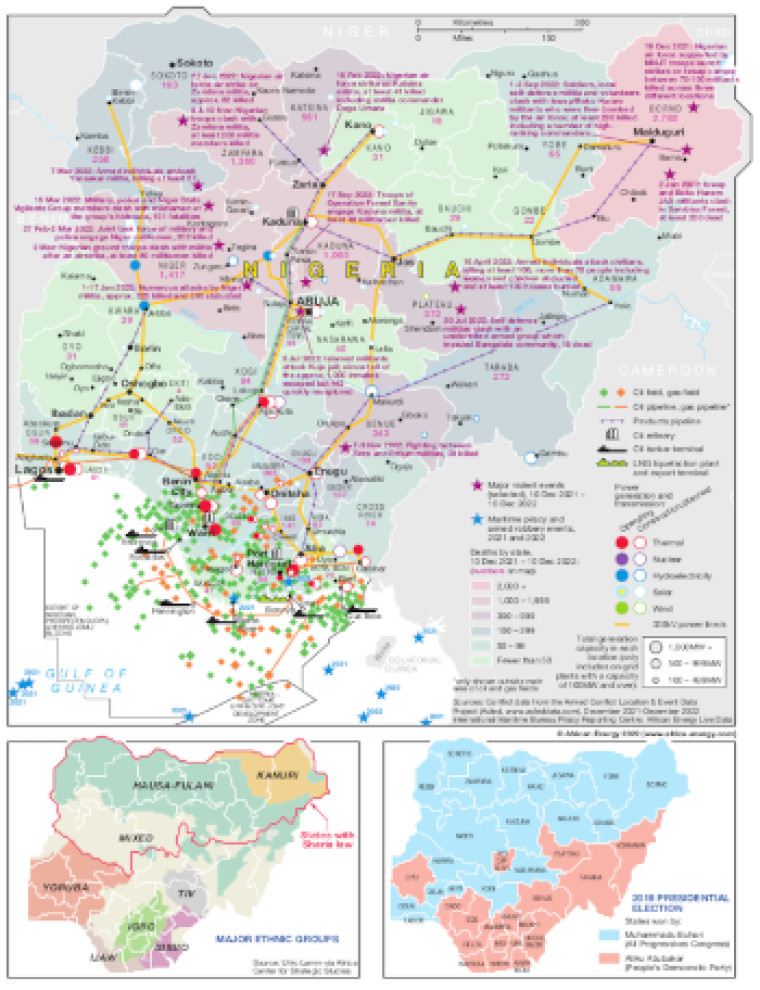
Published December 2022, this map shows the location of major violent events (Dec 2021-Dec 2022) and maritime piracy and armed robbery events (2021 and 2022). The incidents are marked alongside major population centres and energy infrastructure including selected power generation plants and projects, oil and gas producing sites, pipelines, refineries, LNG facilities and tanker terminals.
The map is shaded to represent deaths by state over the last year.
Two smaller maps show the distribution of major ethnic groups and the states won by each of the contenders in the 2019 presidential election.
The map is presented as a PDF file using eps graphics, meaning that there is no loss of resolution as the file is enlarged.
Single African Energy map
£895
(1 standard map)
Subscribe to African Energy
African Energy is a brand of


