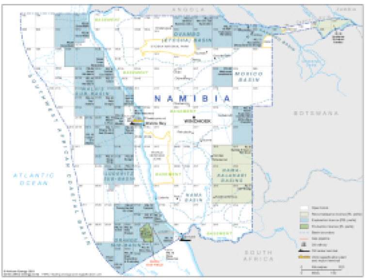
Updated in April 2021, this map provides a detailed overview of the hydrocarbons sector in Namibia.
Acreage is shown with shading designating whether the block is open, a reconnaissance licence or an exploration or production licence. Basin boundaries are shown and block operators named. The map also shows associated infrastructure such as pipelines, tanker terminals, refineries and LNG facilities.
The map is available as a PDF file using eps graphics, meaning that there is no loss of resolution as the file is enlarged.
Single African Energy map
£895
(1 standard map)
Subscribe to African Energy
African Energy is a brand of


