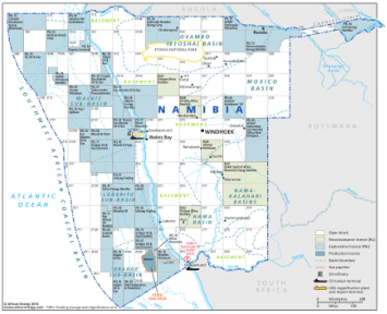
This map – originally published within the African Energy Atlas 2016/2017 – provides an overview of Namibia’s oil and gas sector.
Open and licensed acreage is shown, with block operators marked, alongside associated downstream infrastructure such as a planned LNG regasification plant and import terminal, and oil tanker terminals.
The map is a PDF file, made using eps graphics, meaning that there is no loss of resolution as the file is enlarged.
Single African Energy map
£895
(1 standard map)
Subscribe to African Energy
African Energy is a brand of


