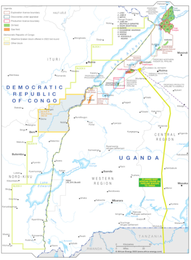
Updated May 2023 this map provides a detailed overview of the hydrocarbons sector in eastern DR Congo and western Uganda, including the oil and gas fields around Lake Albert.
Producing acreage is shown alongside open blocks and areas where exploration activities are underway and discoveries under appraisal.
Block operators are named and oil and gas fields marked, alongside associated mid- and downstream infrastructure including the planned Eacop pipeline and a proposed refinery.
The map is available as a PDF file using eps graphics, meaning that there is no loss of resolution as the file is enlarged.
Single African Energy map
£895
(1 standard map)
Subscribe to African Energy
African Energy is a brand of


