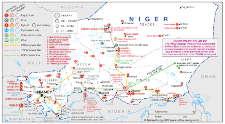
Published April 2023, this map provides a detailed view of the power sector in Niger. The locations of on-grid and off-grid power generation facilities that are operating, under construction or planned are shown by fuel type – including liquid fuels, coal, hybrid, hydroelectricity, solar PV and wind.
Generation sites are marked with different sized circles to show sites of 0.1-9MW, 10-99MW, 100-499MW and 500MW and above.
Existing and future transmission and distribution lines are shown ranging from 66kV to 330kV. Actual and planned cross-border interconnectors are also shown including lines to Burkina Faso and Nigeria.
A small text panel provides details of a West Africa Power Pool (WAPP) secretariat EOI for studies related to the construction of a 150MW solar park.
The maps also shows the location of the Agadem Rift Basin oil fields and the route of the proposed Niger-Benin export pipeline.
Power generation data was drawn from our African Energy Live Data platform, which contains project level detail on power plants and projects across Africa.
The map is presented as a PDF file using eps graphics, meaning that there is no loss of resolution as the file is enlarged.
Single African Energy map
£895
(1 standard map)
Subscribe to African Energy
African Energy is a brand of


