Hydrocarbons in Madagascar and the Indian Ocean islands


Map

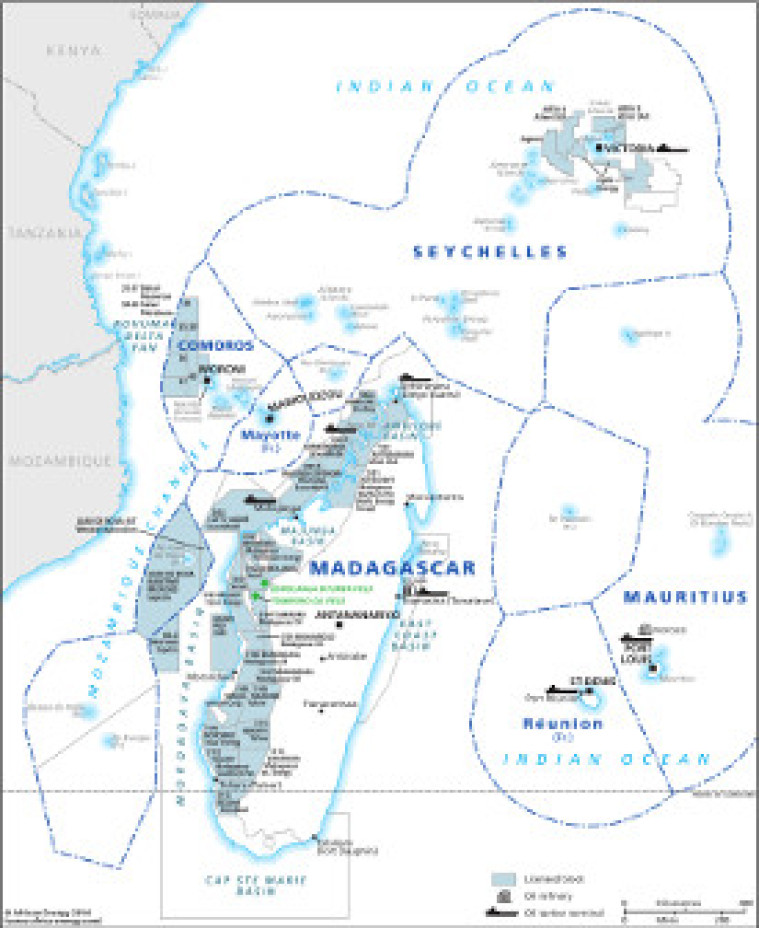
This map provides an overview of oil and gas exploration and production in Madagascar and the Indian Ocean islands. Licensed blocks are shown. With block operators clearly marked on the map. Details include associated downstream infrastructure including refineries and oil tanker terminals. The map is a PDF file, made using eps graphics, which do not lose resolution as they are enlarged.

Single African Energy map

£895

(1 standard map)

Subscribe to African Energy

View subscription options

Don't have an account?

Register for access to our free content

An account also allows you to view selected free articles, set up news alerts, search our African Energy Live Data power projects database and view project locations on our interactive map

Register

Interested in more than one map?

The African Energy Atlas is the essential reference book for all energy professionals working in Africa, with maps, graphics and articles covering all aspects of the energy sector.

Take a closer look