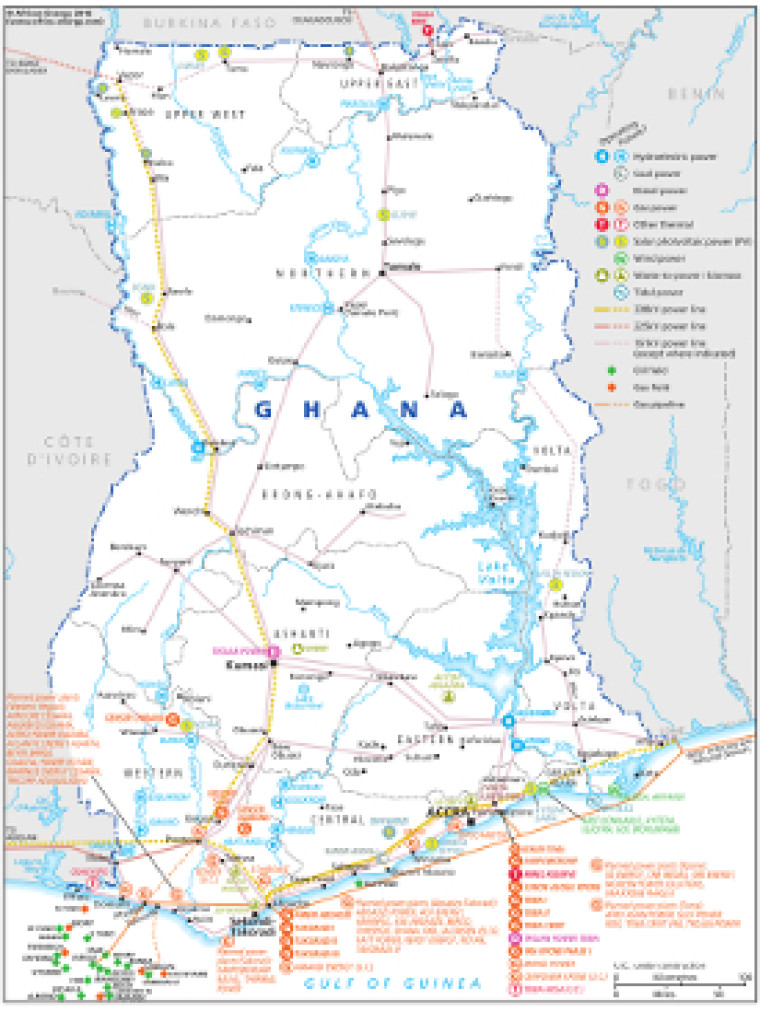
Revised in December 2016, this map provides an overview of Ghana's energy sector, with a predominant focus on power sector infrastructure.
The locations of actual and planned power generation facilities are shown by type (including hydroelectric, thermal, solar PV, wind, tidal, coal and waste-to-power) alongside existing and future transmission lines, ranging from 66kV to 330kV.
Offshore oil and gas fields are indicated with the route of the WAGP marked.
The map is a PDF file, made using eps graphics, meaning that there is no loss of resolution as the file is enlarged.
Single African Energy map
£895
(1 standard map)
Subscribe to African Energy
African Energy is a brand of


