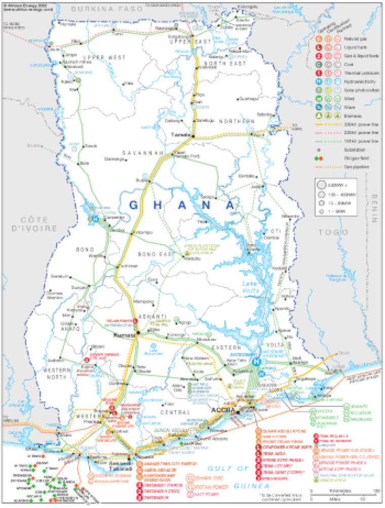
Revised in September 2022, this map provides a detailed view of the power sector in Ghana. The locations of power generation facilities that are operating, under construction or planned are shown by type – including liquid fuels, gas and liquid fuels, natural gas, coal, hydroelectricity, solar (PV), wind, wave and biomass.
Generation sites are marked with different sized circles to show sites of 1-9MW, 10-99MW, 100-499MW and 500MW and above.
Existing and future transmission and distribution lines are shown ranging from 161kV to 300kV. Actual and planned cross-border interconnectors are also shown including lines to Burkina Faso, Côte d'Ivoire and Togo.
The locations of offshore oil and gas fields and pipelines are also marked.
Power generation data was drawn from our African Energy Live Data platform, which contains project level detail on power plants and projects across Africa.
The map is presented as a PDF file using eps graphics, meaning that there is no loss of resolution as the file is enlarged.
Single African Energy map
£895
(1 standard map)
Subscribe to African Energy
African Energy is a brand of


