Exploration and production in Cameroon and Equatorial Guinea


Map
Issue 213
02 July 2011

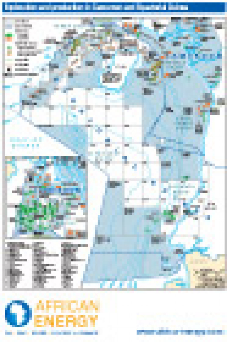
Revised July 2011, this map shows offshore and coastal onshore open and licensed acreage in Cameroon and Equatorial Guinea. Detail includes major oil and gas fields, block names and operators, plus refineries, tanker terminals and existing and planned gas infrastructure offshore Malabo

Single African Energy map

£895

(1 standard map)

Subscribe to African Energy

View subscription options

Don't have an account?

Register for access to our free content

An account also allows you to view selected free articles, set up news alerts, search our African Energy Live Data power projects database and view project locations on our interactive map

Register

Interested in more than one map?

The African Energy Atlas is the essential reference book for all energy professionals working in Africa, with maps, graphics and articles covering all aspects of the energy sector.

Take a closer look