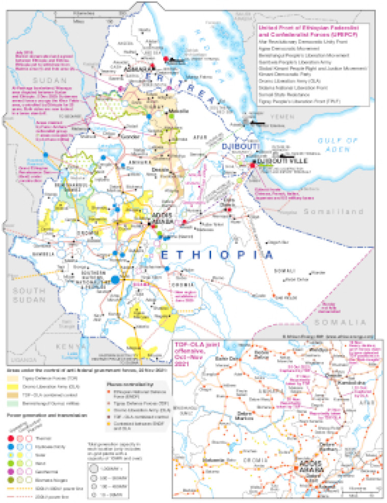
Published November 2021, this map focuses on Ethiopia's critical power infrastructure and illustrates conflict zones across the country.
The main map shows areas under the control of anti-federal government forces alongside operating, under construction and planned power generation sites (marked according to size and main fuel type) and transmission lines (actual and planned ranging from 230kV to 500kV).
The map also shows key infrastructures sites in neighbouring Eritrea and Djibouti (including tanker terminals and refineries) and highlights additional areas of potential conflict or contention.
An inset map illustrates the Tigray Defence Forces (TDF) and Oromo Liberation Army (OLA) joint offensive over October-November 2021 – places controlled and contested by the Ethiopian National Defence Force (ENDF) TDF and OLA are marked.
The map is available as a PDF file using eps graphics, meaning that there is no loss of resolution as the file is enlarged.
Single African Energy map
£895
(1 standard map)
Subscribe to African Energy
African Energy is a brand of


