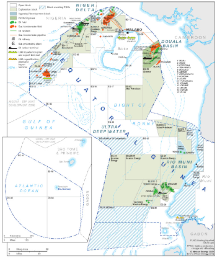
Updated December 2022, this map provides a detailed overview of the hydrocarbons sector in Equatorial Guinea.
Open blocks are shown alongside exploration blocks, appraisal/development blocks, producing areas and blocks awaiting PSCs. Block operators are shown. Oil and gas fields are marked, alongside associated downstream infrastructure such as pipelines, tanker terminals, refineries, gas processing plants and LNG facilities.
The map is available as a PDF file using eps graphics, meaning that there is no loss of resolution as the file is enlarged.
Single African Energy map
£895
(1 standard map)
Subscribe to African Energy
African Energy is a brand of


